Selway-Bitterroot Wilderness
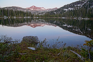
The Bitterroot Mountains form a rugged, glacier-carved border between Idaho and Montana. On both sides of this border is the Selway-Bitterroot Wilderness, the third largest Wilderness in the Lower 48....
Description from Wilderness Connect (wilderness.net), where the full text continues.
| Designation | Wilderness |
| Managed by | U.S. Forest Service |
| States | Idaho, Montana |
| Size | 1.3 million acres (Wilderness Connect) |
| Designated | 1964, by Congress |
| Center point | 46.1298, -114.7257 |
| Night sky | About as dark as the ground gets (Black Marble reading 12) |
Boundary map
Boundary, simplified to about 0.005 degrees Federal campground Forest Service recreation site
The outline is the agency boundary simplified for display, so small parcels and inholdings may not show. The agency page has the authoritative map.
Weather by month
Large units span more than one climate. The station stands in for the center point, and the outer parts of the boundary can be warmer or colder.
Where to camp
1 federal campground sits inside the boundary and 35 more are within ten miles of it. Nearest first. Distances are from the campground point to the boundary edge, from the Campsite Atlas index.
Show 4 moreHide
24 more within ten miles are not listed here.
Trailheads and sites
The Forest Service lists 2 recreation sites inside this wilderness, among them 1 campground, 1 horse Riding. Each links to its page on fs.usda.gov, which carries the season, fees and current status.
- 23 miLost Spring Campground ↗Campground · 7/15
- 41 miSelway-Bitterroot Wilderness ↗Horse Riding
Distance is from the center point of the boundary, not from a road or town.
Trails
203 named Forest Service trails enter this wilderness, 1,611 miles in all. The 10 longest are listed here.
| Trail | Miles | Allowed uses |
|---|---|---|
| Eagle Mountain ↗ | 43 | |
| Selway River Trail ↗ | 38.4 | |
| East Moose Creek ↗ | 36.3 | |
| Nez Perce Indian Trail ↗ | 34.7 | |
| Big Rock ↗ | 32 | |
| Beaver Ridge ↗ | 30 | |
| Boulder Creek ↗ | 27.5 | |
| North Moose/Isaac Lake ↗ | 26.1 | |
| Lost Horse ↗ | 25.5 | |
| Whitecap Creek ↗ | 24.6 |
Lengths and allowed uses come from the Forest Service trail layer by way of Trailhead Atlas, refreshed September 18, 2026. Trails in plain text have no page there yet.
Fire nearby
- WildfireThree Links
19 mi from the center point · 927 acres · 21% contained
- WildfireNorth Fork Lost Horse
19 mi from the center point · 118 acres · 70% contained
- WildfireWolf Creek
20 mi from the center point · 2,643 acres · 50% contained
- WildfireCascade
20 mi from the center point · 7,475 acres · 70% contained
Distance is to the reported incident point, not the fire edge, and is measured from the center of a boundary that may be many miles across. Check the agency page for closures.
Explore
Nearby on the other atlases
- 0 miGardiner Peak Lookout ↗Darby (mt), ID
- 0 miSt. Mary Peak Lookout ↗Stevensville, MT
- 0.8 miSalmon Mountain Lookout ↗Darby (mt), ID
- 1 mi
- 2.7 miEl Capitan Lodge ↗Hamilton, MT
- 2.8 miHayward Lodge ↗Darby, MT
- 4.4 miCarlton Community Church ↗Florence, MT
- 4.6 mi
Landmarks are listed first, then by distance from the boundary.
Reference
Questions people ask
How big is Selway-Bitterroot Wilderness?
1.3 million acres.
Source: Wilderness Connect
Who manages Selway-Bitterroot Wilderness?
The U.S. Forest Service.
Source: Wilderness Connect
What state is Selway-Bitterroot Wilderness in?
The boundary crosses Idaho and Montana.
Source: Wilderness Connect
When was Selway-Bitterroot Wilderness designated?
Congress designated it in 1964.
Source: Wilderness Connect
Can I camp at Selway-Bitterroot Wilderness?
1 federal campground sits inside the boundary, including Lost Spring Campground. 36 in all are within ten miles. Camping inside a wilderness is usually allowed away from roads, with no facilities; the managing agency page has the permit rules.
Source: Where to camp
Where are the trailheads in Selway-Bitterroot Wilderness?
The Forest Service lists 2 recreation sites here, including 1 campground campground and 1 horse riding. Each one links to its Forest Service page.
Source: Trailheads and sites
How do I get to Selway-Bitterroot Wilderness?
A point inside the boundary is at 46.130, -114.726. Nez Perce National Historical Park is 25 miles away. The official page carries directions and the office address.
Source: Wilderness Connect
Is there a fire near Selway-Bitterroot Wilderness right now?
4 active incidents within 50 miles as of 2026-09-18, the nearest Three Links at 19 miles. Distance is to the reported incident point, not the fire edge.
Source: Fire nearby
How dark is the night sky at Selway-Bitterroot Wilderness?
NASA’s Black Marble night-lights image reads 12 on a 0 to 255 scale at the center point, about as dark as the ground gets.
Source: NASA Black Marble
Which national parks are near Selway-Bitterroot Wilderness?
Nez Perce National Historical Park (25 mi). Park Atlas has fees, hours and alerts for each.
Source: Nearby on the other atlases
Sources
- Boundary, name, acreage, designation year, states and description: Wilderness Connect.
- Campgrounds: the Campsite Atlas index of federal campgrounds, matched to this boundary at build time.
- Trailheads and sites: the Forest Service Recreation Opportunities layer, points inside the boundary.
- Trails: the Trailhead Atlas open-data file of Forest Service trails, matched on the wilderness each trail enters.
- Night sky: NASA Black Marble (VIIRS, 2016 composite) sampled at zoom 6 around the center point.
- Weather, alerts, air quality, river flow and earthquakes load live in your browser from NWS, AirNow, USGS and iNaturalist when you open the page.